Do not follow where the path may lead. Go instead where there is no path and leave a trail. –Ralph Waldo Emerson
The Friday Hoofer hikes are the longest, have more climb, and are consistently the most strenuous of the five groups. Please consult with one of the hike leaders before hiking with this group. We normally ask potential Friday Hoofers to first hike with the Wednesday Striders.
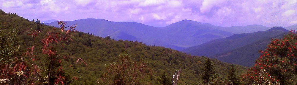
Here is a Friday Hoofer Video that describes some of the fun we experience during our hikes.
Time: Unless noted in the hike description the regular start time is 9:00 am. Please arrive 10 minutes early for a prompt departure.
Updates: Updates are posted on the Updates page every Thursday morning before the Friday hike, and sometimes at other times. Because of the uncertain weather in Western North Carolina an update may be posted the morning of the hike changing or cancelling the hike. Hikers are encouraged to check for updates before heading to the meeting place. If you would like to receive updates sent directly to your email, press the “+Follow” button at the lower right hand corner of any web page and provide your email address. Hkers can Unsubcribe by clicking that button on the top of the Update email they receive.
Note: Do NOT reply to the Update emails. Only use the RSVP link to reply.
Assembly: Four different Assembly Area locations are generally used depending upon the location of the hike. The schedule specifies a starting location for each hike, which differs from hike to hike. The four starting locations are the Pisgah Ranger Station/Visitor Center, Walmart parking lot in Pisgah Forest, Catheys Creek Road at US64 and the Cedar Mountain Community Center parking lot. Details for each location are given in the Assembly Areas tab. Note: the assembly area may be different from these three areas so always check the Update for the hike.
Photos: Pictures taken during some of the hikes can be found here.
Friday Hoofer Hike Leaders :
Vic Zona–victor.zona@sbcglobal.net
Friday Hoofers Spring 2026 Schedule
Our start time for the Spring Quarter hikes will be 9:00 AM.
Hikes with longer drive times will meet earlier and noted in the weekly update.
April 3, Laurel Valley to Sassafras Mountain
9.25 mi, 2,218’ cl, R10
Meet at the Laurel Valley parking area
We will be hiking the Foothills trail starting from the Laurel Valley parking area off of 178 up to the Sassafras lookout for lunch. We may see a variety of wildflowers on this is an out and back hike. Please RSVP jelute@princeton.edu to attend this hike.
April 10, Foothills Trail (A8 – A9)
9.5 mi, 1,900’ cl, R10
Meet at Cathys Creek Road parking area
This is a new Hoofers hike, at least for me. The trail starts at the Whitewater Falls Parking Area off of 281 and goes south along a scenic forested trail. The terrain consists of rolling hills with few steep sections. The trail ends at the Sloan Bridge Picnic Area next to route 107. This is an out and back hike. There is a $3.00 fee for parking at Whitewater or free if you have a National Parks Pass.
April 17, Soapstone Ridge (P400)
10 mi, 1280’ cl, R10+
Meet at the Pisgah Ranger Station
From the Pink Beds parking we hike Barnett Branch to Soapstone Ridge, then take the South Mills River trail to Buckhorn, stopping for lunch at the Buckhorn shelter. Continue on Black Mountain to Barnett Branch and on to a user trail down to the Cradle of Forestry and back to our cars. Please RSVP Sharon at sharonbode1@gmail.com if you plan on hiking.
April 24, Black Mountain to Club Gap Shuttle (P400)
11.2 mi, 2900′cl, R10+
Meet at the Pisgah Ranger Station
From the PRS parking lot we start the hike on Thrift Cove and hike entire the Black Mountain Trail to Club Gap then down the Club Gap Trail to our shuttle on Avery Creek Road. Please RSVP Kristen at kristenwho62@yahoo.com if attending.
May 1, Bear Branch, Double Head, Pine Mtn, Bad Fork loop (P400)
8.5 mi, 1,600’cl, R10+
Meet at Walmart or the Mills River Ingles
From the North Mills River area, we hike up Bear Branch to Double Head, then over Pine Mtn then downhill on Bad Fork back to our cars.
May 8, Reasonover Mine Mountain Ramble
11 miles, 1,500’cl, R10
Meet at Fawn Lake parking
We will start this hike on the Reasonover Creek trail with a side trip to the
Popular trail to look for the Yellow Lady Slippers. Then continue onto numerous trails back to the parking lot. Contact Kelly at kellyleann@comcast.net to sign up.
May 15, Mont Cammerer via the AT
11.5 mi, 3,221’ cl, R10+
Early starting time
Meet at Walmart at 8:15 or Ingles Mills River at 8:30
We hike the AT trail to Mt. Cammerer for lunch then return. Contact Debbie Jones at Djones715@aol.com or 404-731-3119.
NOTE: A parking pass for each vehicle is required in the GSMNP. For more information: https://www.nps.gov/grsm/ planyourvisit/fees.htm
May 22, Green River Gameland
10 mi, 1,969’cl, R10
Meet at Pisgah Walmart or Ingles Upward Road in Hendersonville
From the parking area on Big Hungry Road, we will hike various trails down to the Green River and looping back up to cars. Please RSVP Sharon at sharonbode1@gmail.com if you plan on hiking.
May 29, Sam’s Gap to Big Bald via the AT
13 mi, 3,209’ cl, R10+
Early Start Time
Meet at Walmart at 8:15 or Ingles Mills River at 8:30
The views on Big Bald are worth the 6.5 miles and 2,000 feet of climb to get there, but it’s mostly downhill on the way back. This will be an out and back hike. Please RSVP jelute@princeton.edu to attend this hike.
June 5, Montreat Gate to Rocky Head Loop
11 mi, 3209’cl, R10+
Meet at the Pisgah Walmart or Ingles in Mills River
This hike takes us over and along several peaks on the way to the top of Rocky Head before looping back to our cars. Before heading back to Brevard, we may stop at My Father’s pizza for a slice and a drink.
June 12, Lemon Gap to Max Patch
11 mi, 1,800’ cl, R10
Early starting time
Meet at Walmart at 8:15 or Ingles Mills River at 8:30
We will begin hiking at Lemon Gap, have lunch on top of Max Patch with its scenic 360-degree views, and then return to our cars. This is an out and back hike.
June 19, Bearwallow-Strawberry Gap
10 mi, 2572’cl, R10
Meet at Walmart at 8:00 or Ingles Upward Road in Hendersonville at 8:45
We begin at the Strawberry Gap parking area and hike Strawberry Gap and Trombatore Trails to Bearwallow Mt. After lunch we will hike down Bearwallow, Trombatore and Strawberry Gap back to our cars. With any luck we will see blooming trilliums along the Trombatore Trail. Please RSVP Tim at tkthorpe1@yahoo.com if you plan on hiking.
June 26, Cataloochee Divide
12 mi, 2,000’cl, R10+
Meet at Walmart or the Mills River Ingles
We follow the Cataloochee Divide Trail out to the Swag Resort and back.
NOTE: A parking pass for each vehicle is required in the GSMNP. For more information: https://www.nps.gov/grsm/ planyourvisit/fees.htm
