Do not follow where the path may lead. Go instead where there is no path and leave a trail. –Ralph Waldo Emerson
The Friday Hoofer hikes are the longest, have more climb, and are consistently the most strenuous of the five groups. Please consult with one of the hike leaders before hiking with this group. We normally ask potential Friday Hoofers to first hike with the Wednesday Striders.
Here is a Friday Hoofer Video that describes some of the fun we experience during our hikes.
Time: Unless noted in the hike description the regular start time is 9:00 am. Please arrive 10 minutes early for a prompt departure.
Updates: Updates are posted on the Updates page every Thursday morning before the Friday hike, and sometimes at other times. Because of the uncertain weather in Western North Carolina an update may be posted the morning of the hike changing or cancelling the hike. Hikers are encouraged to check for updates before heading to the meeting place. If you would like to receive updates sent directly to your email, press the “+Follow” button at the lower right hand corner of any web page and provide your email address. Hkers can Unsubcribe by clicking that button on the top of the Update email they receive.
Note: Do NOT reply to the Update emails. Only use the RSVP link to reply.
Assembly: Four different Assembly Area locations are generally used depending upon the location of the hike. The schedule specifies a starting location for each hike, which differs from hike to hike. The four starting locations are the Pisgah Ranger Station/Visitor Center, Walmart parking lot in Pisgah Forest, Catheys Creek Road at US64 and the Cedar Mountain Community Center parking lot. Details for each location are given in the Assembly Areas tab. Note: the assembly area may be different from these three areas so always check the Update for the hike.
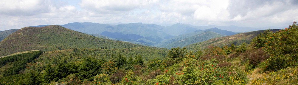
Photos: Pictures taken during some of the hikes can be found here.
Friday Hoofer Hike Leaders :
Vic Zona–victor.zona@sbcglobal.net
Friday Hoofers Summer 2026 Schedule
Our start time for the Summer Quarter hikes will be 8:30 AM.
Hikes with longer drive times will meet earlier and noted in the weekly update.
July 3, Laurel Mountain / Pilot Rock loop (P400)
10.2 mi, 2,700’ cl, R10+
Meet at the Ranger Station
Beginning at the Buck Springs over look, we begin our hike down the Laurel Mountain trail to a user trail down to the Slate Rock Creek. After crossing the creek we head to the Pilot Cove loop for lunch on Slate Rock. After lunch we head to the Pilot Rock trail and back up to our cars. RSVP Sharon at sharonbode1@gmail.com to attend this hike.
July 10, Lemon Gap to Max Patch
11 mi, 1,800’ cl, R10+
Meet at Walmart at 8:00 or Ingles Mills River at 8:15
We will begin hiking at Lemon Gap, have lunch on top of Max Patch with its scenic 360-degree views, then reverse our steps back to our cars.
July 17, Hemphill Bald loop
13.8 mi, 2,780’ cl, R10+
Meet at Walmart at 8:00 or Ingles Mills River at 8:15
Beginning at Polls Gap, we hike to Hemphill Bald then complete the loop hiking the Caldwell Fork and Rough Fork trails back to the cars.
RSVP Debbie Jones at Djones715@aol.com or 404-731-3119 if you plan on hiking.
This hike is in the Smokies and all cars require a parking pass. For more information: https://www.nps.gov/grsm/planyourvisit/fees.htm.
July 24, Tanyard Gap to Lovers Leap
Hike 8.5, 2200 ft. ascent
Meet at Walmart at 8:00 or Ingles Mills River at 8:15
This hike will be a moderate loop in the Hot Springs area. Starting from Tanyard Gap, we will follow the Appalachian Trail Southbound to the intersection with the Lovers Leap Trail and proceed to the old Silvermine group camp. Continuing on the Pump Gap Trail, we’ll then head back to the A.T. to return to our cars.
July 31, Butter Gap / Cat Gap Loop (P400)
11 mi, 2,500’ cl, R10+
Meet at the Ranger Station
Leaving the Fish Hatchery parking lot, cross the bridge, turn right onto Cat Gap Trail to Butter Gap Trail, then straight onto ALT. From the ALT we will take a user trail on the left up to Cedar Rock Mountain for lunch. We will take a different user trail down to re-connect with the ALT leading us back to the Cat Gap Trail. At the Cat Gap intersection we’ll return to our cars via John Rock and the Cat Gap Trails.
August 7, Newfound Gap, Charlie’s Bunion, Kephart Prong shuttle (SB6K)
11.2 mi, 1,700’ cl, R10+
Meet at Walmart at 8:00 or Ingles Mills River at 8:15
This scenic hike will follow the A.T. from Newfound Gap to Charlies Bunion for lunch then hiking back on the Dry Sluice trail to our shuttle at the Kephart Prong Trailhead. NOTE: A parking pass for each vehicle is required in the GSMNP. For more information: https://www.nps.gov/grsm/planyourvisit/fees.htm. RSVP jelute@princeton.edu to attend this hike. If you wish to drive up the night before, meet the Ingles group at the Smoky Mt Ranger Station on Rte 441. On the return home there will be an option to have dinner in Cherokee.
August 14, Coontree to Buckwheat Knob and back (P400)
9.6 mi, 2,270’ cl, R10+
Meet at the Ranger Station
In a clockwise direction we hike Coontree Trail up to Bennett Gap and on to Buckwheat Knob. After lunch we reverse our steps and complete the Coontree Trail loop back to our cars. RSVP Kelly at kellyleann@comcast.net to sign up.
August 21, Mt. Mitchell to Walker Knob via Blackstock Knob (SB6K)
9.5 mi, 1,600’ cl, R10+
Meet at Walmart at 8:00 or Ingles Mills River at 8:15
This is one of the really great sections of the MST and includes two SB6K peaks. This hike features exceptional views south from the Black Mtns.
August 28, Gloucester Gap to Fish Hatchery shuttle (P400)
9.5 mi, 2,100’cl, R10
Meet at the Pisgah Forest Ranger Station
This will be a shuttle hike starting from the Art Loeb at Gloucester Gap,
then over Chestnut Mountain to the Cedar Rock Mountain and continuing on the Art Loeb to John Rock and down to Cat Gap to our shuttle at the Fish Hatchery.
September 4, Woodfin Cascades to Waterrock Knob and back
10.4 miles, 2,400’ cl, R10+
Meet at the Cathy’s Creek Road
Starting at the Woodfin overlook on the BRP, we will hike the MST to Waterrock Knob for lunch and great views before reversing our track back to our cars.
RSVP Kristen at kristenwho62@yahoo.com if you plan on hiking.
September 11, Shining Creek Trail to Shining Rock (P400 and SB6000)
9 mi, 2,675’ cl, R10+
Meet at the Ranger Station
From the Shining Creek Parking area off of 276 we hike the Shining Creek Trail up to Shining Rock for lunch then reverse the hike back to our cars. RSVP Sharon at sharonbode1@gmail.com to attend this hike.
September 18, Case Camp/Seniard Ridge (P400)
10.6 mi, 2,600’ cl, R10+
Meet at the Ranger Station
From the Case Camp trailhead on 475B we hike up to the BRP to the MTS trail. We continue on the MTS trail to Graveyard Fields. We walk the BRP to the Seniard Ridge trail and hike back to our cars. RSVP Sharon at sharonbode1@gmail.com to attend this hike.
September 25, Art Loeb trail to Shining Rock
10.2 mi, 2,160’ cl, R10+
Meet at the Ranger Station
Taking the ALT from the Big Sam parking lot, we hike up to Black Balsam then to Tennent Mountain before making our way to Shining Rock. For the return trip we can either reverse our steps or hike the Ivestor Gap trail (road). RSVP Tim at tkthorpe1@yahoo.com to sign up.
