The Monday Milers hikes are more challenging than the Friday Rollers hikes. The average moving pace is 2-1/4 mph. Hikers should be comfortable hiking 7-10 miles and 1000-1500′ ascent.
Regular departure time and place: The Pisgah Forest Lowe’s Home Center at the curb closest to and parallel with US 64. Depending on hike location, we will occasionally meet at alternate locations. See weekly emailed hike announcements for hike departure times and locations. Usually, we leave at 8:45 in the Winter months and 8:15 in the Summer months. Always RSVP the hike announcement if you plan to hike.
The schedule below may change based on conditions. Mileages and ascents shown are approximate.
Hike leaders:
Olin Redmon: (843) 812-2225, olinredmon@gmail.com
Jerry Yunker: (337) 230-6905, mylonitejy@gmail.com
If you are interested in trying these hikes but have questions please contact Olin.
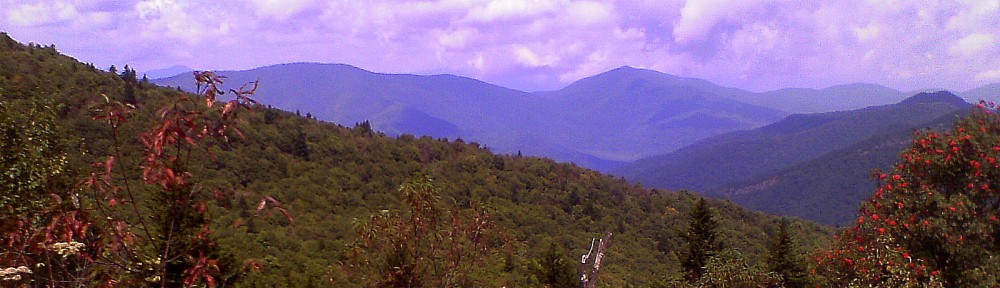
“Walking is the best medicine.”–Hippocrates
MONDAY MILERS: SPRING 2026
| Mar. 30 |
TURKEY PEN TO PRESSLEY COVE |
8.4 miles, 1700′ ascent |
A shuttle hike. From Turkey Pen parking we take Turkey Pen Gap trail to near Black Mtn., where we take a user trail to Black Mtn. trail to Maxwell Gap trail to Pressley Cove and our shuttle. |
| Apr 6 |
WAGON GAP TO PISGAH INN |
7 miles, 1100′ ascent |
A shuttle hike beginning at the Wagon Road Gap overlook parking on the BRP and heading up to Pisgah Inn. |
| Apr 13 |
BUBBLING SPRINGS LOLLIPOP |
9.5 miles, 1300′ ascent |
From parking at Bubbling Springs we take the MST to Devils Courthouse to Art Loeb and the Black Balsam trailhead, Flat Creek to Little Sam trail and back via MST. |
| Apr 20 |
PANTHERTOWN:GRANNY BURRELL’S APPLE TREE |
7.7 miles, 550′ ascent |
A double lollipop from Cold Mtn. Gap parking we hike out Panthertown Valley road to Big Gap trail to Granny Burrell’s apple tree. Then we will visit Frolictown, Wilderness Falls and Salt Rock Overlook, then return via Macs Gap, Green Valley and Panthertown Valley road, stopping by Schoolhouse Falls. |
| Apr 27 |
COVE CREEK LOOP |
9 miles, 1200′ ascent |
From Cove Creek parking we take Cove Creek to Caney Bottom to Upper Cove Creek to Cove Creek Rd. to Daniel Ridge Loop to Lanning Ridge Rd. and back to cars. |
| May 4 |
HEADWATERS: TURKEY MTN. LOOP |
7.6 miles, 900′ ascent |
TBD |
| May 11 |
PANTHERTOWN:WALLS AND FALLS |
8 miles, 1000′ ascent |
A loop from Cold Mtn. Gap parking we hike out Mac’s Gap trail then Big Green trail, onto Great Wall trail, then Granny Burrell Falls trail to Wilderness Falls trail to Salt Rock overlook for lunch, then return to car(s) on Panthertown Valley trail, stopping at Schoolhouse Falls. |
| May 18 |
BRACKEN MOUNTAIN TO FISH HATCHERY |
7.7miles, 1200’ ascent |
Shuttle hike, we start at the Bracken Mountain parking , hike up to 475C and take a connector trail to the Art Loeb trail for lunch, we go from there down either left or right on Cat Gap Loop to finish. |
| May 25 |
BENNETT GAP/COONTREE LOOP |
7.0 miles, 1,600’ ascent |
From parking on Avery Creek Rd., hike up Bennett Gap to lunch spot with a view of Looking Glass Rock, retrace steps to Coontree (right), hike the loop and take a right back on Bennett Gap and return to cars. |
| Jun 1 |
BLACK BALSAM TO GRAVEYARD FIELDS |
7 miles, 1000′ ascent, 1600′ descent |
A shuttle hike. From Big Sam parking we hike the Art Loeb over Tennant Mtn. to Ivestor Gap, then Graveyard Ridge trail and the MTS to Graveyard Fields. |
| Jun 8 |
OPEN |
|
|
| Jun 15 |
BUBBLING SPRINGS TO SUNBURST |
8.8 miles, 1000′ ascent, 2800′ descent |
A shuttle hike. From parking on 816 we take the MST to Green Knob trail to Green Knob, and then on to our cars at Sunburst Campground.. |
| Jun 22 |
VINEYARD GAP LOOP |
9 miles, 1100′ ascent |
From Turkey Pen parking we take Vineyard to Riverside trails to Bradley Creek and Laurel Creek trails to Squirrel Gap, back to Bradley Creek and South Mills River Road back to cars. |
| Jun 29 |
SOAPSTONE RIDGE FIGURE 8 |
9.1 miles, 1300’ ascent |
From Pink Beds we go clockwise to Barnett Branch to the Soapstone Ridge user trail, then on South Mills River trail to the Gauging Station, then Pink Beds Connector and Loop back to cars. |
|
|
|
|